
Rocks are solid. Water is fluid. However, given enough time, water can even wear rocks down, creating a type of topography called “karst.”
Karst topography is a fascinating landscape shaped by the gradual yet persistent dissolution of soluble rocks. This blog explores the formation and types of karst topography and brings you to notable karst areas around the world.
What is karst topography?
Karst topography is a geological formation that results from the dissolution of soluble carbonate rocks such as limestone and dolomite. Under specific conditions, even harder rocks like quartzite (7 out of 10 on the Mohs scale) can exhibit karst-like features.
Karst topography forms due to the action of surface or groundwater, which gradually dissolves the underlying rock, leading to distinctive landforms.
The term “karst” originates from the German language, which was adopted in the late 19th century to describe such landscapes in Europe.
Research indicates that about 10% of the Earth’s surface consists of karst topography, highlighting its significant presence in the natural world. Karst topography is found in various climates, from humid mid-latitude regions to tropical, alpine, and even polar areas. Yet, it’s most commonly associated with regions rich in carbonate rocks.
Research also shows that carbonate rocks make up only 8.8% of the land surface in tropical regions and 7.7% in polar areas. In contrast, temperate climates contain the highest proportion at 19.1%, followed by cold regions at 16.8% and deserts at 14.8%.
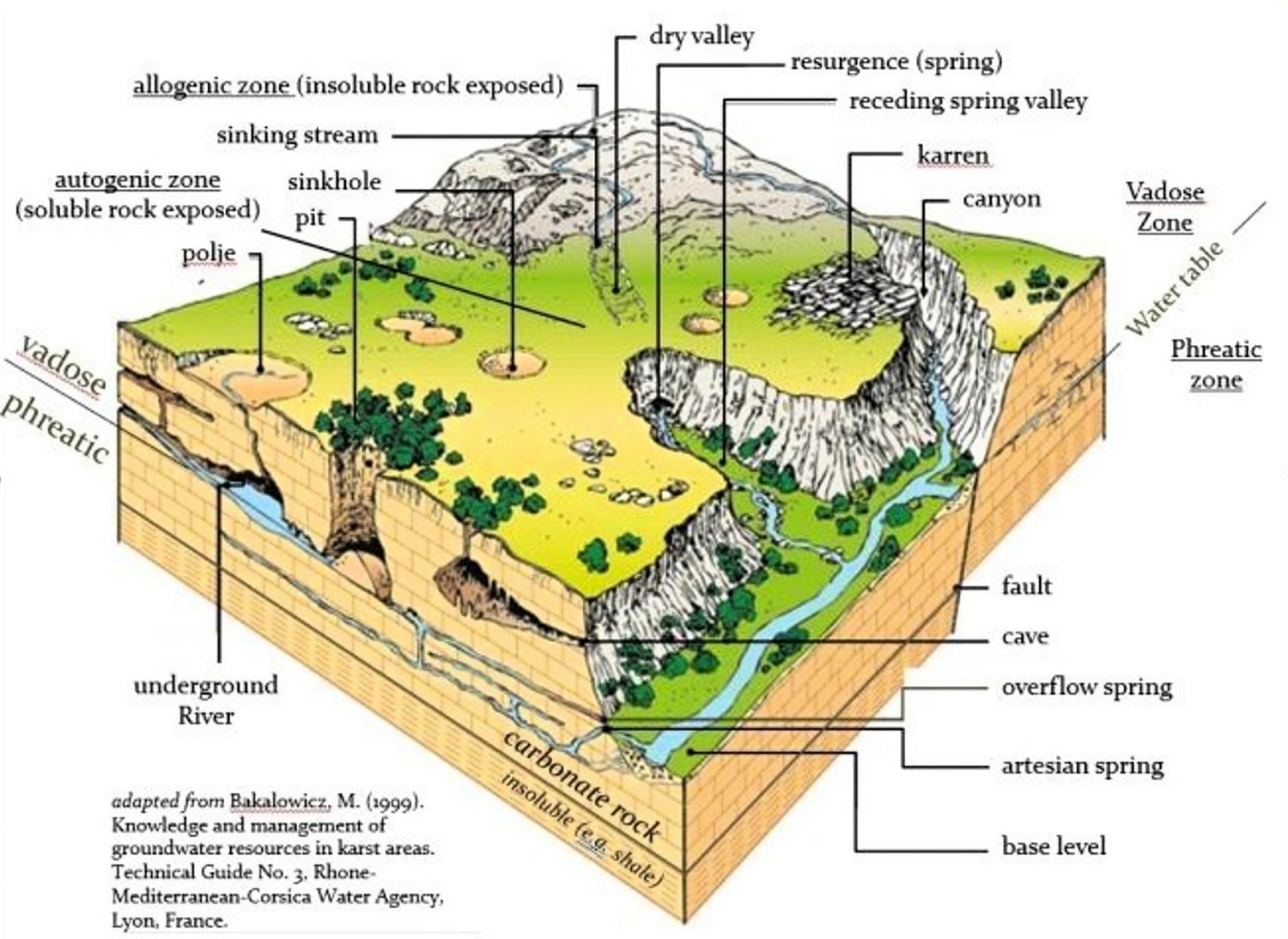
Over millions of years, the dissolution of rocks creates cracks that evolve into channels and, in some cases, expand into vast cave systems. These processes contribute to the formation of sinkholes, vertical shafts, underground rivers, and disappearing or reappearing springs, all of which are characteristic of karst topography.
Beyond its geological importance, karst topography plays a crucial role in global water resources. According to research, up to 25% of the world’s population relies on groundwater sourced from karst regions. This makes understanding karst essential for water management, environmental conservation, and land-use planning.
The formation of karst topography
The formation of karst topography (karstification) begins with the interaction between water and carbon dioxide (CO2). As rainwater passes through the atmosphere, it absorbs CO2, which dissolves in water. Upon reaching the ground, the water may infiltrate the soil, where additional CO2 is introduced through soil respiration.
This process results in the formation of a weak carbonic acid solution, which gradually dissolves calcium carbonate in rocks. For karst formation to occur, sufficient rainfall is necessary to sustain the continuous dissolution of carbonate rocks over time.
Although carbonic acid is the primary agent of karst formation, in rare cases, oxidation can also contribute. The oxidation of sulfides can lead to the formation of sulfuric acid (H2SO4), which accelerates the erosion process. When oxygen-rich surface water infiltrates deeper karst systems, it reacts with sulfides present in the rock to form sulfuric acid, which then dissolves calcium carbonate at an even faster rate.
As a result, both surface and underground landscapes develop distinct features. Some of the most commonly found surface formations include:
- Limestone pavement
- Sinkholes (cenote)
- Vertical shaft
- Karst valley
- Karst tower
Beneath the surface, these features include caves and caverns. Inside, various formations known as speleothems develop through the deposition of calcium carbonate and other dissolved minerals. Among the most common speleothems are:
- Stalactites
- Stalagmites
- Pillars
Stalactites are slender, pointed structures that hang from the ceilings of caves, gradually forming as mineral-rich water drips down. Stalagmites, on the other hand, rise from the cave floor as mineral deposits accumulate from dripping water.
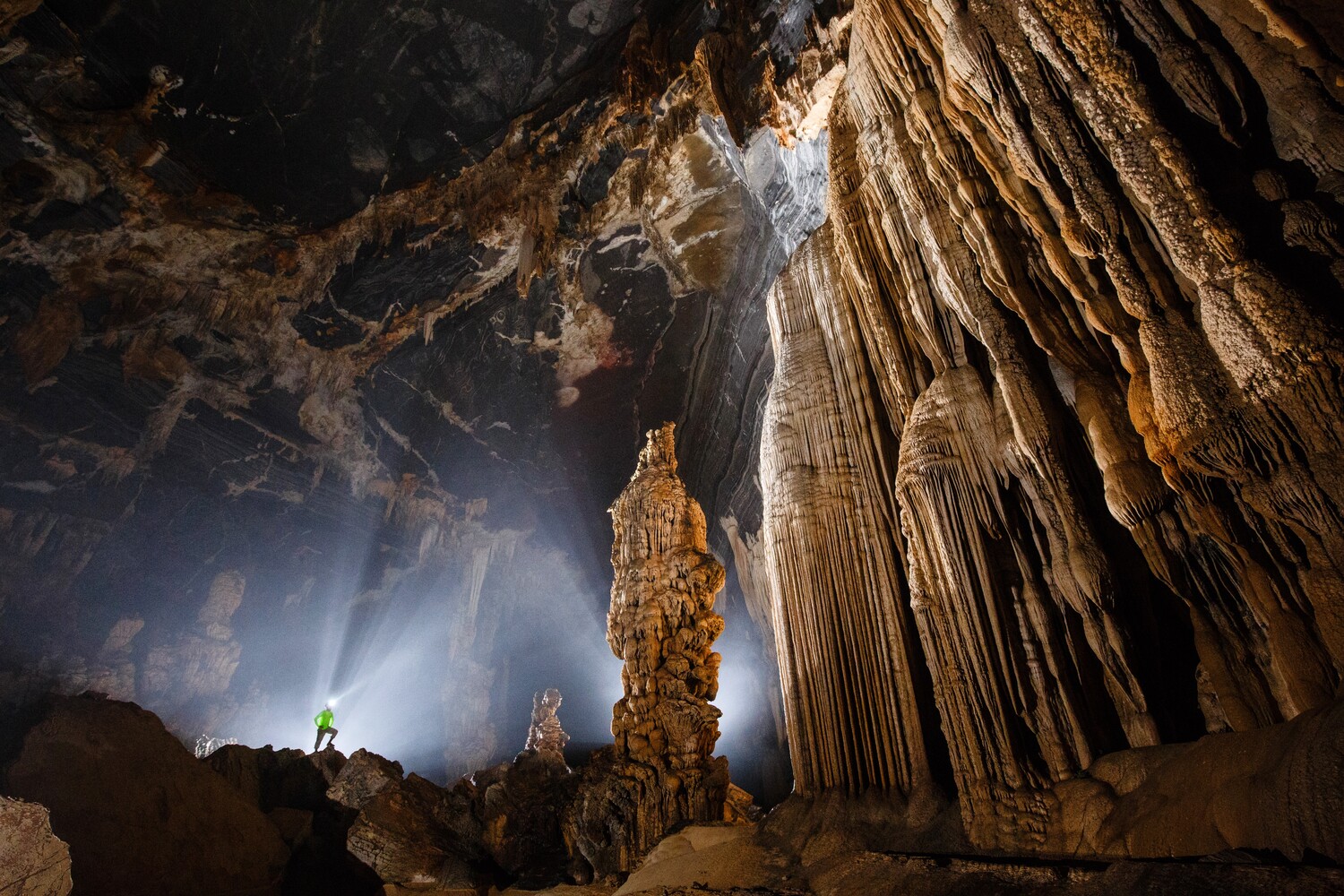
Over time, a stalactite extending downward may eventually connect with a stalagmite growing upward, merging to form a solid pillar.
The extent and severity of karst development depend on various factors, including geological, climatological, hydrological, and biological influences. Rocks undergoing karst development are typically thick, sparsely bedded, and heavily jointed. Of course, human activities can either accelerate or alter karst formation.
Types of karst topography
Karst topography has five main types: interstratal karst, kegelkarst, salt karst, karst forest, and pseudokarst, each with unique characteristics and formation processes.
Interstratal karst
Interstratal karst develops beneath a layer of non-soluble rock, such as sandstone, that overlays limestone undergoing dissolution. This karst landscape forms underground cavities and drainage systems that may eventually lead to surface collapse.
Kegelkarst
Kegelkarst is a tropical karst landscape characterized by numerous cone-shaped hills, formed by features like cockpits and mogotes. Unlike other karst terrains, kegelkarst lacks strong fluvial erosion, leading to its distinct, rugged appearance.
Salt karst
Salt karst occurs in regions where underground salt deposits dissolve, creating surface depressions and collapses, which can pose significant geological hazards.
Karst forests
Karst forests are challenging to navigate and often relatively undisturbed. This allows karst forests to preserve unique ecosystems. The high-pH soil promotes the growth of unusual plant species, including orchids, palms, and mangroves.
Pseudokarst
Pseudokarst resembles true karst landscapes but forms through different processes, such as volcanic activity creating lava caves or weathering shaping granite tors.
Karst areas around the world
Karst topography is found worldwide. As mentioned above, the distribution of karst areas depends on various factors. Below are ten of the most popular in the world:
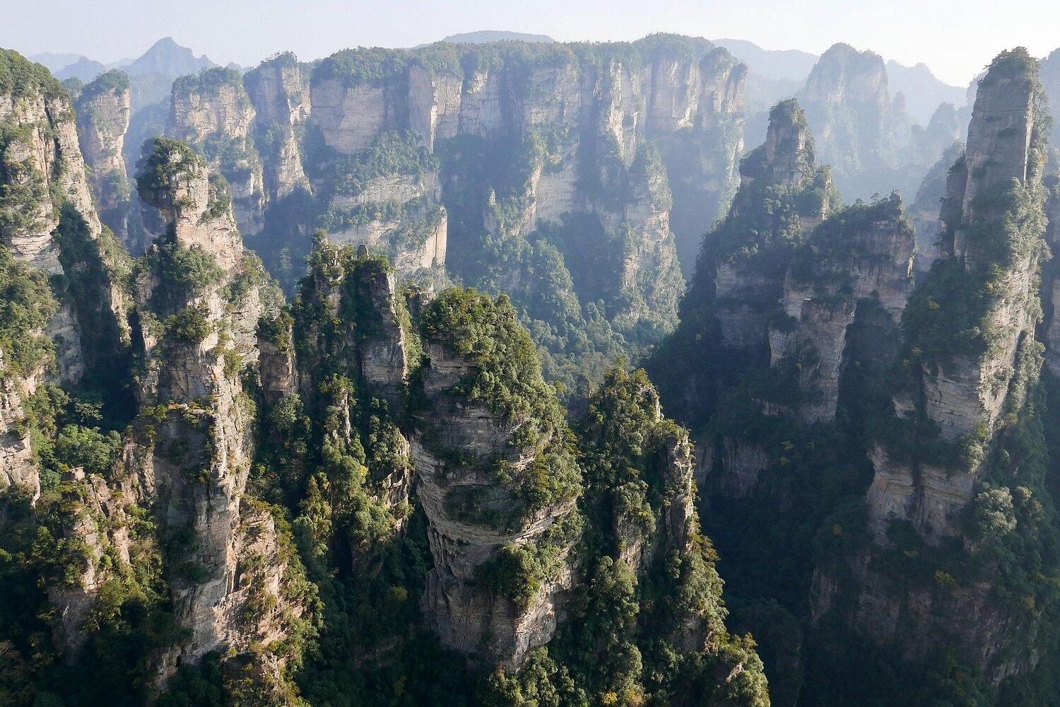
1. Zhangjiajie National Forest Park (China)
Zhangjiajie National Forest Park, located in Hunan Province, is one of China’s most stunning karst landscapes. The park is renowned for its towering, densely clustered sandstone pillars, which were formed over millions of years through erosion and weathering processes. The dramatic limestone formations in Zhangjiajie, some rising over 1,000 meters, inspired the floating mountains in the movie Avatar.
China has the largest karst area in the world, covering about 2.55 million km2, or 26.5% of the country’s landmass. The humid subtropical climate and abundant vegetation in Zhangjiajie contribute to the park’s biodiversity, making it home to rare plants and endangered wildlife, like the Giant Salamander. Every year, Zhangjiajie attracts over 5 million visitors for its breathtaking scenery and geological significance.
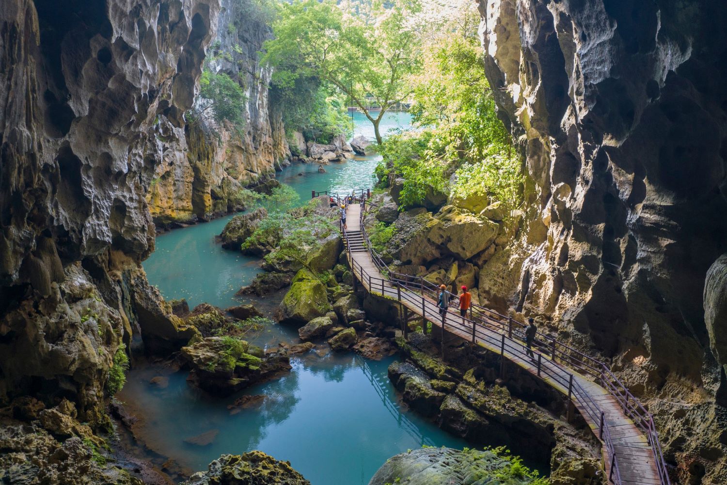
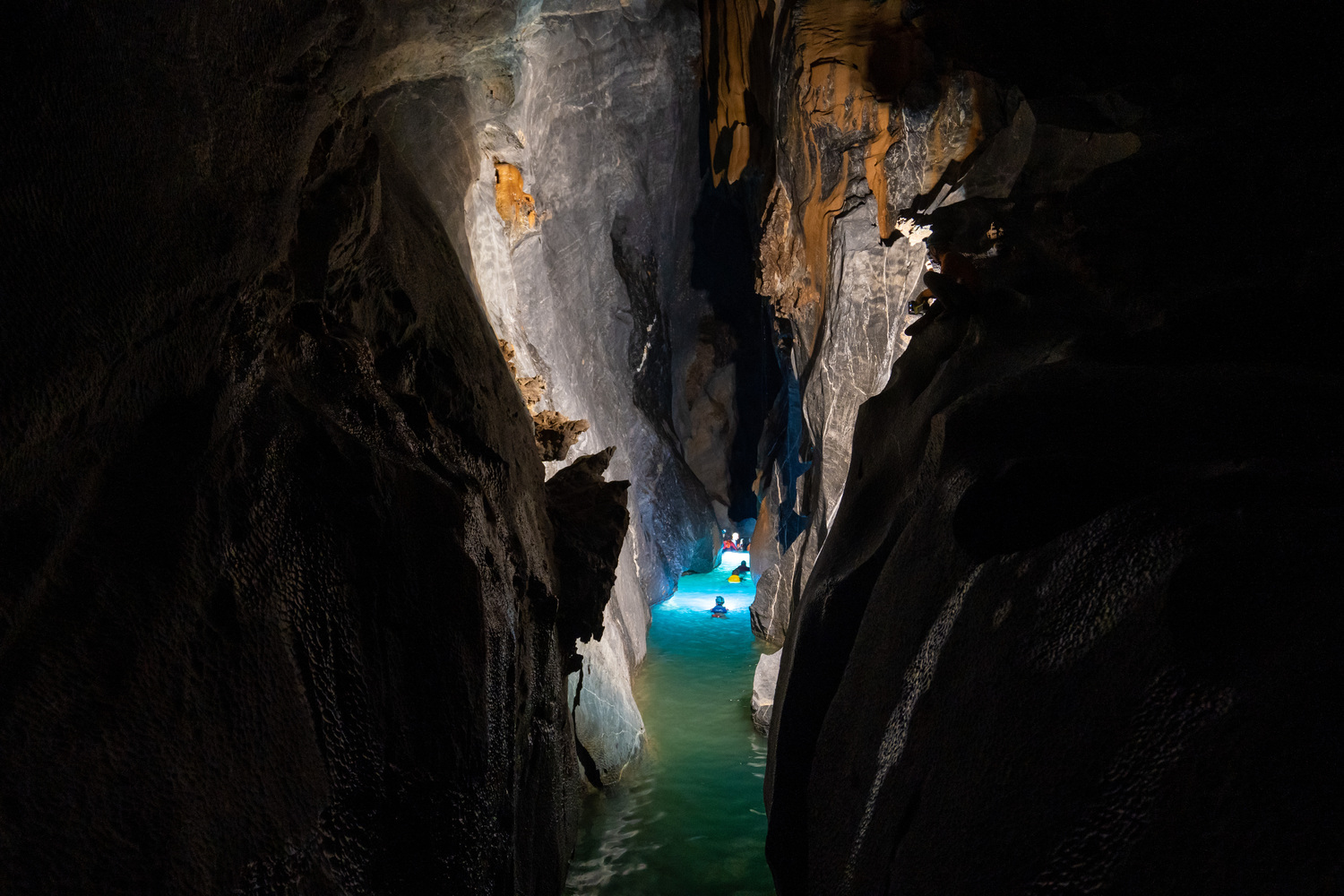
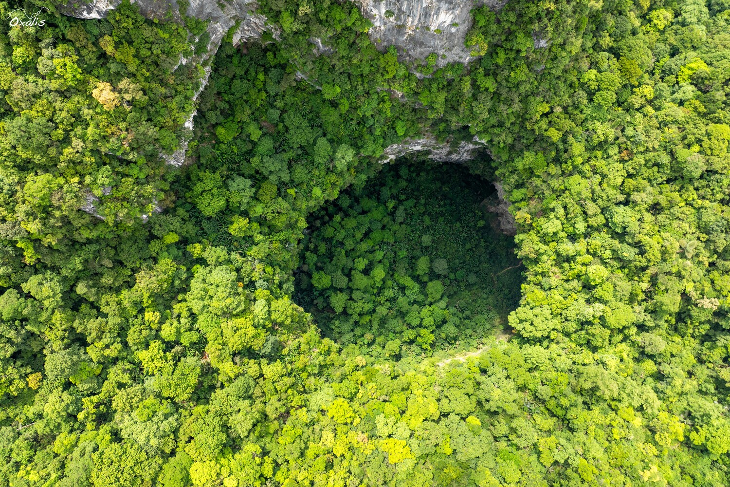
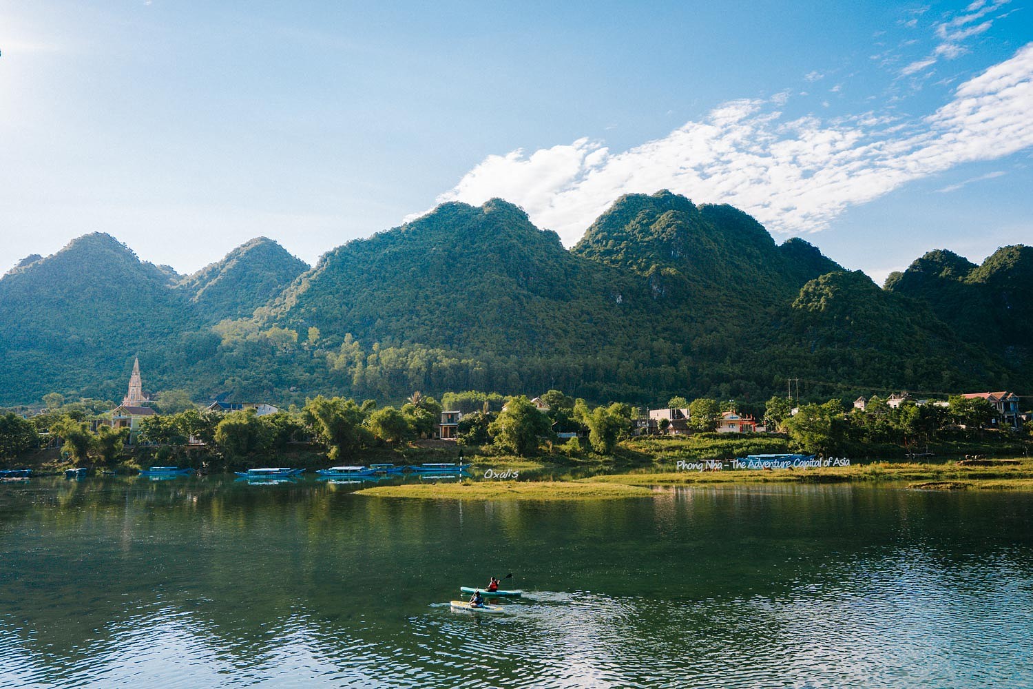
2. Phong Nha – Ke Bang National Park (Vietnam)
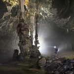
Phong Nha – Ke Bang National Park, located in Quang Binh Province, Vietnam, is a UNESCO World Heritage Site famous for its extensive karst formations, underground rivers, and vast cave systems. The park features over 300 caves, including Son Doong Cave, the largest cave in the world. These caves were shaped by millions of years of water erosion, creating unique stalactites, stalagmites, and subterranean landscapes.
Phong Nha – Ke Bang also supports rich biodiversity, hosting over 2,700 plant species and numerous rare animals such as the Asian black bear and the saola. Phong Nha’s karst terrain plays a vital role in the area’s water systems, acting as a natural reservoir. Beyond its scientific importance, the park attracts visitors and researchers, offering unparalleled opportunities for exploration, eco-tourism, and geological studies.
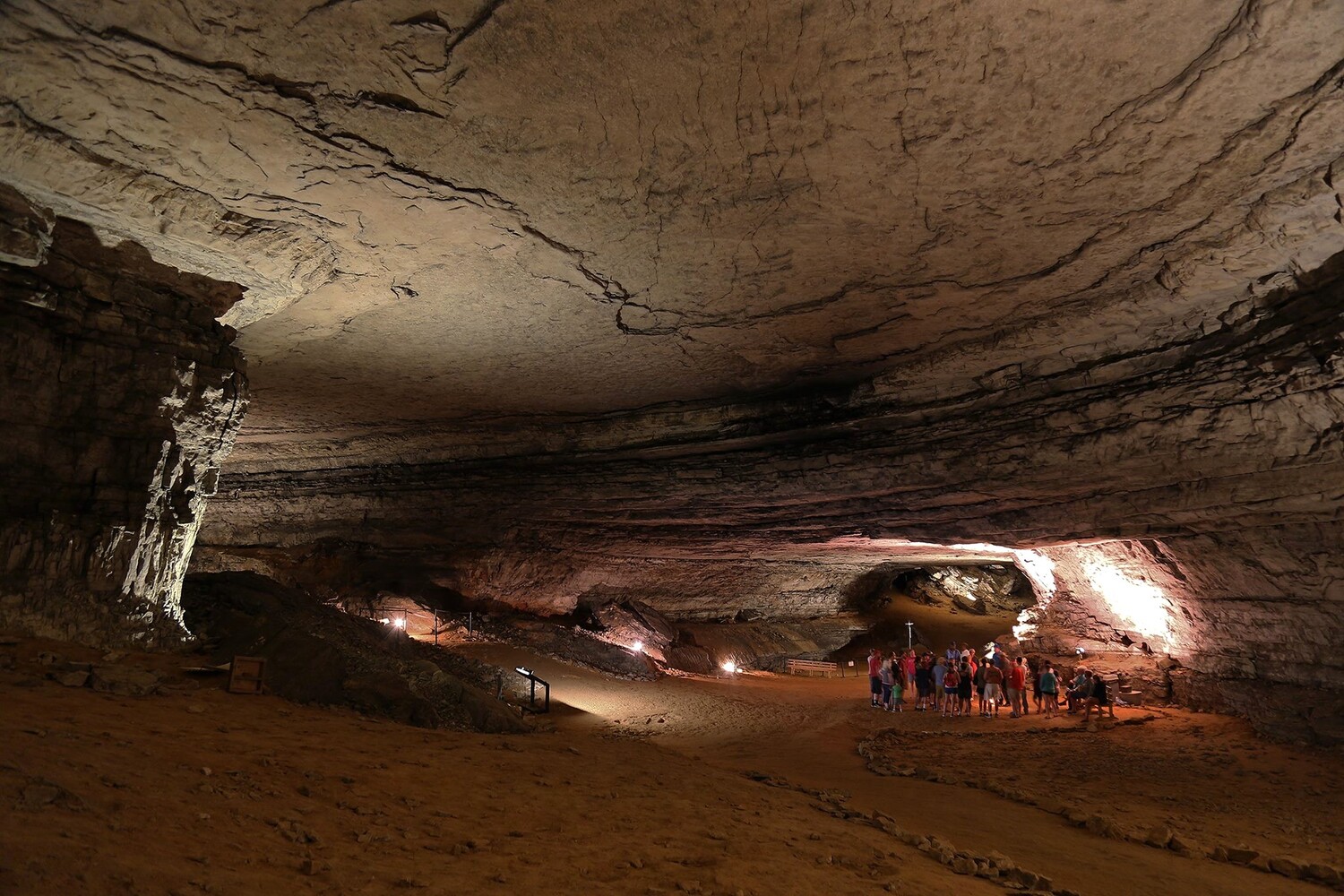
3. Mammoth Cave National Park (United States)
Mammoth Cave National Park, located in Kentucky, the United States, is home to the world’s longest cave system, with 426 miles (686 km) of explored passages. This vast karst landscape was formed by the dissolution of limestone by acidic groundwater over millions of years, creating a labyrinth of tunnels, chambers, and underground rivers. The cave system itself is rich in speleothems, including stalactites and stalagmites.
Mammoth Cave National Park also contains unique cave-dwelling species such as blind fish, albino shrimp, and cave salamanders. In Mammoth Cave, a significant portion of the water travels beneath the surface through underground cave systems. As a result, much of the water’s movement is hidden. Today, Mammoth Cave remains a vital scientific area, providing insight into karst hydrology and underground ecosystems.
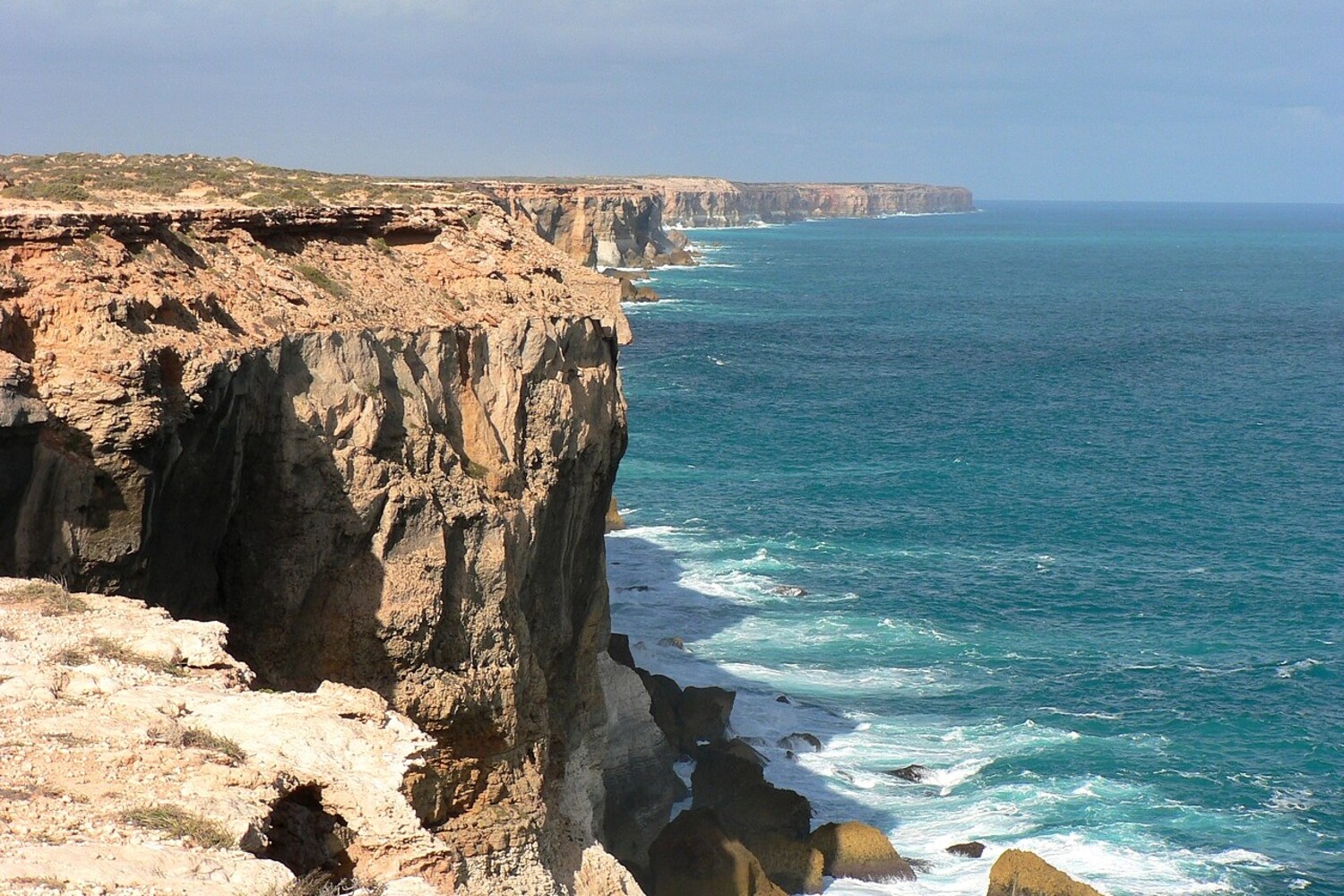
4. Nullarbor Plain (Australia)
The Nullarbor Plain, located in southern Australia, is one of the world’s largest karst areas that are exposed on the ground surface, covering 200,000 km2. At its widest, it spans 684 miles (1,100 km) along the South Australia–Western Australia border. The area is characterized by extensive cave systems, blowholes, and underground rivers. Its name, derived from Latin, means “no trees,” reflecting its vast, arid expanse.
The Nullarbor Plain is home to unique karst features, including the Murrawijinie Caves, which contain ancient Aboriginal rock art. Despite its harsh conditions, the Nullarbor supports diverse wildlife, including wombats, dingoes, and red kangaroos. Due to its remoteness and lack of surface water, it remains largely uninhabited. Yet, the area is one of Australia’s most popular routes for scenic drives among locals and tourists.
5. Arabika Massif (Georgia)
The Arabika Massif, Georgia, is one of the most significant karst areas in the world and is known for its deep cave systems. Due to its high elevation, the Arabika Massif is home to the trio of deepest caves in the world—Krubera-Veryovkina-Sarma caves, at 2,224, 2,209, and 1,830 meters, respectively. The massif’s limestone formations have been shaped by glacial and hydrogeological processes over millions of years.
Arabika’s karst landscape includes extensive underground rivers, vertical shafts, and massive caverns. The region’s harsh mountain climate and rugged terrain create a challenging environment, but its caves continue to attract scientists for speleological explorations. The fact that this region has three of the deepest caves in the world shows that the geological and hydrological processes here were extremely active.
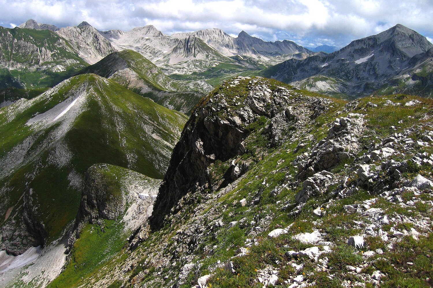
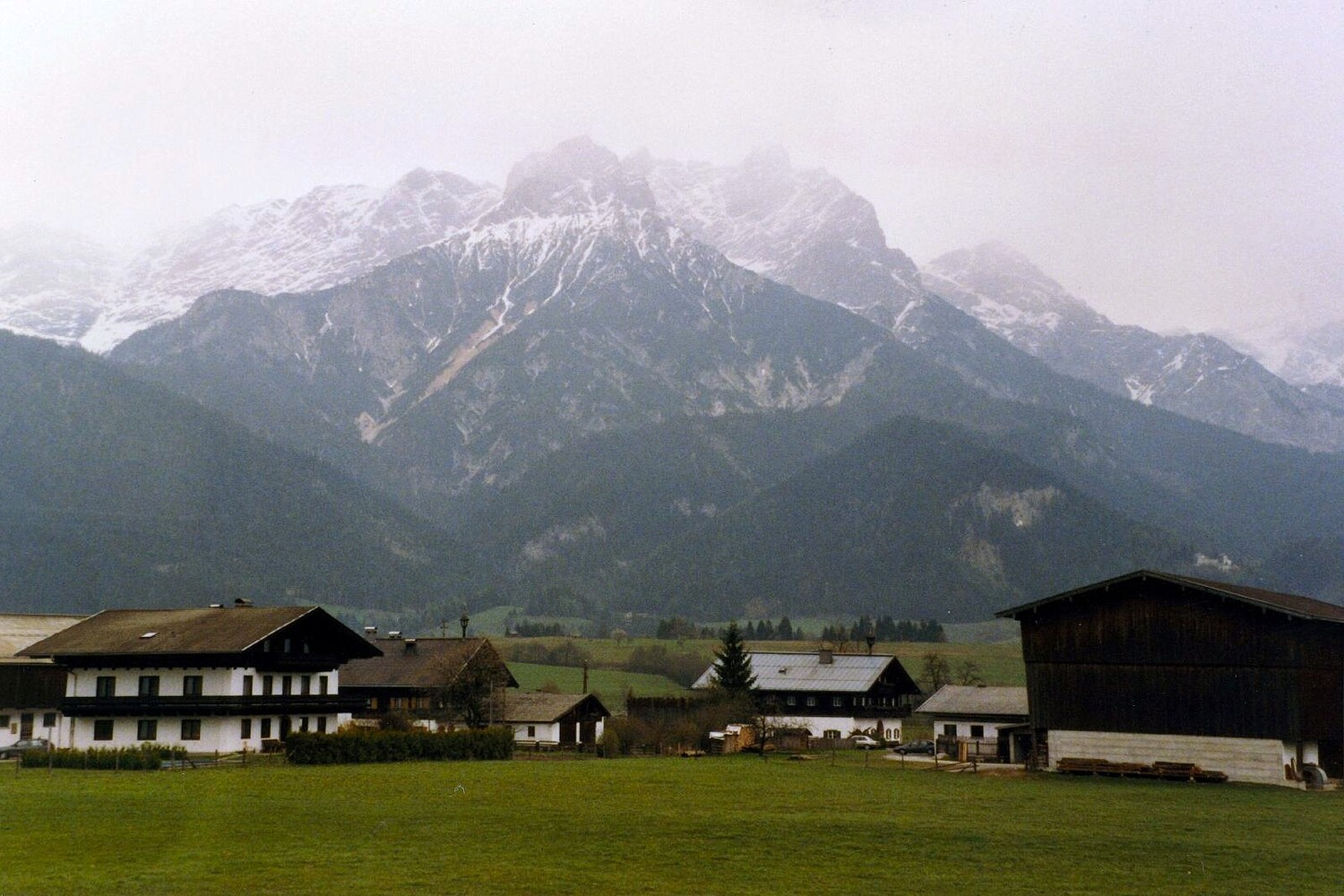
6. Northern Limestone Alps (Austria)
The Northern Limestone Alps stretch across Austria and the Bavarian parts of Germany, forming an extensive karst landscape characterized by rugged peaks, deep valleys, and intricate cave systems. The region is primarily composed of Permian–Jurassic limestone and dolomite, which have been eroded by water over millions of years. With a total area of 10,000 hectares, it’s a major attraction for hikers, geologists, and cave explorers.
The Tennen Mountains in the Northern Limestone Alps are home to Eisriesenwelt, the world’s largest ice cave. The mountain peaks in the area often endure strong winds and storms. The highest peaks in the Northern Limestone Alps are over 3,000 meters. At high elevations, these bring biting cold, with heavy ice, sleet, and snow. The region is also known for its alpine meadows, glacial remnants, and diverse flora and fauna.
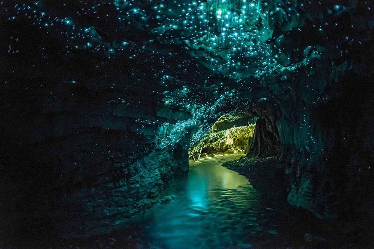
7. Waitomo (New Zealand)
Waitomo, located on New Zealand’s North Island, is a rural community famous for its extensive and unique limestone cave systems. The Waitomo Caves are best known for their spectacular cave glowworms (Arachnocampa luminosa), which illuminate the caverns with a bioluminescent blue glow. This unique ecosystem thrives in the humid, dark cave environment, drawing over half a million visitors each year.
The name “Waitomo” comes from the Māori words wai (water) and tomo (hole or shaft). The karst landscape of Waitomo features underground rivers, sinkholes, and stunning stalactites and stalagmites. Tours to Waitomo Caves typically lead visitors through three distinct cave levels. Many end with a boat ride through the Glowworm Grotto, where cave glowworms illuminate the underground Waitomo River like a starry sky.
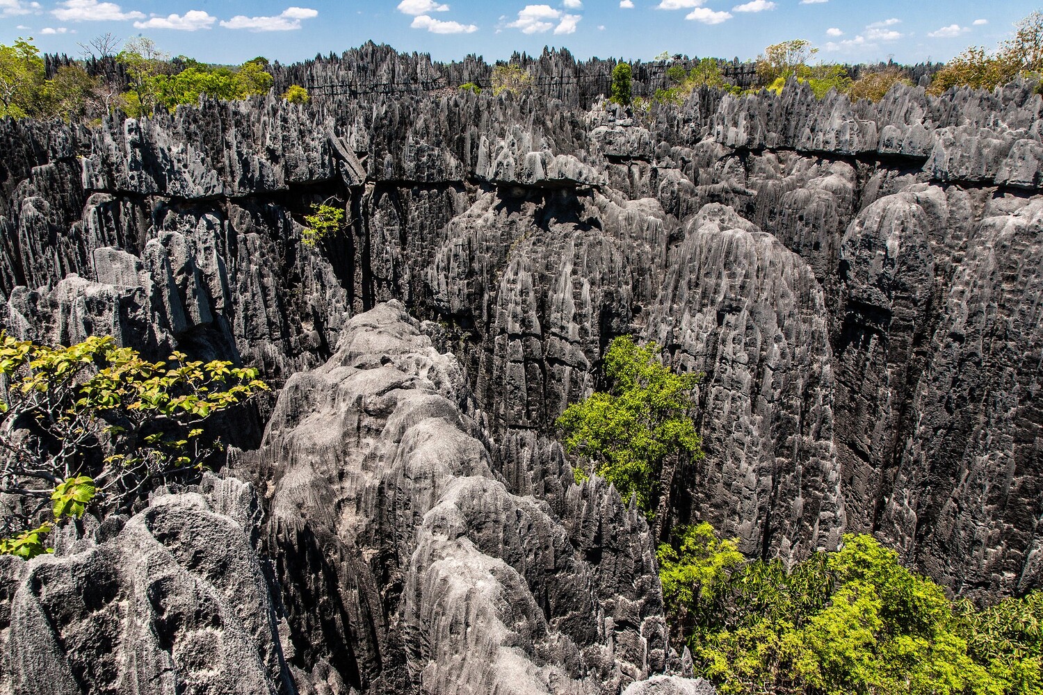
8. Tsingy de Bemaraha National Park (Madagascar)
Tsingy de Bemaraha National Park in Madagascar is one of the world’s most unique karst landscapes, known for its dramatic limestone pinnacles, called “tsingy.” The name itself means “where one cannot walk barefoot” in Malagasy. These sharp, needle-like formations were created by the erosion of limestone over millions of years. The park is also home to deep gorges, gouged caves, and underground rivers.
Due to its isolation and rugged terrain, Tsingy de Bemaraha National Park hosts diverse and endemic wildlife, including lemurs, chameleons, and rare bird species. Recognized as a UNESCO World Heritage Site, Tsingy de Bemaraha National Park is not only an extraordinary example of tower karst topography but also a vital ecological reserve, protecting one of the most biologically diverse regions in Madagascar.
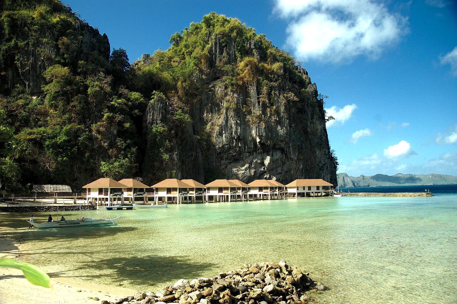
9. El Nido (Philippines)
El Nido, located on Palawan Island in the Philippines, is a famous municipality known for its dramatic limestone karst formations, turquoise lagoons, coral reefs, and hidden caves. The karst landscape here was formed through the gradual erosion of limestone by rain and seawater over millions of years. Towering limestone cliffs rise from the sea, creating a striking contrast with the surrounding crystal-clear waters.
El Nido’s karst topography also includes extensive cave systems, such as Cudugnon Cave, which contains ancient human artifacts. The region is home to a rich marine ecosystem, with coral reefs, diverse fish species, and nesting sea turtles. Thanks to its breathtaking scenery and diverse tourist attractions, El Nido has become a premier ecotourism destination, attracting over 500,000 visitors each year.
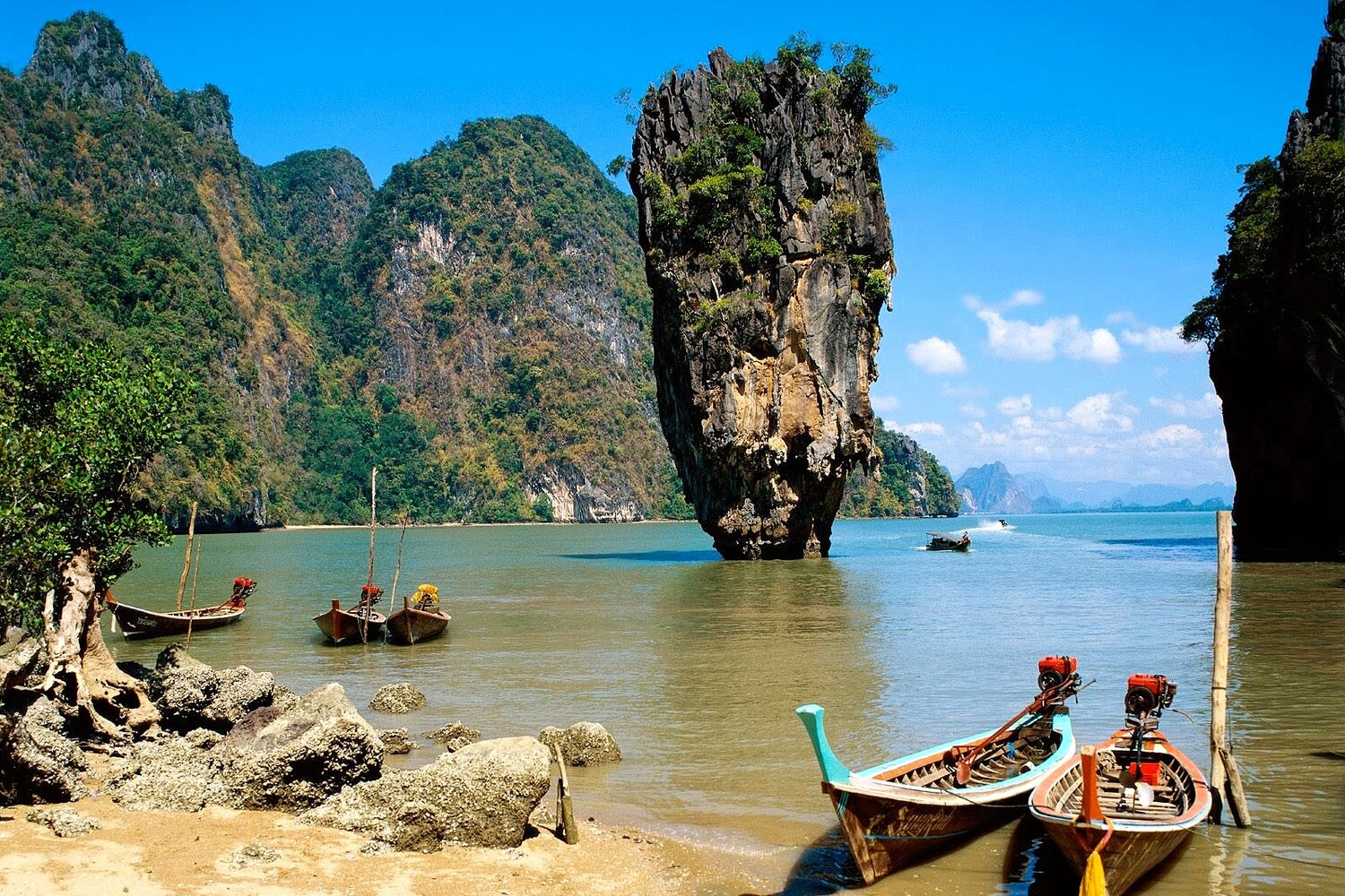
10. Phang Nga Bay (Thailand)
Phang Nga Bay, located in southern Thailand near Phuket, is a stunning karst seascape known for its towering limestone cliffs, caves, and emerald-green waters. Similar to El Nido, rainwater and tidal erosion have shaped these dramatic karst formations, creating sea arches, caves, and isolated limestone islands. The most famous of these is James Bond Island (Ko Tapu), which appeared in The Man with the Golden Gun (1974).
Phang Nga Bay is also home to rich biodiversity, including mangrove forests, hidden lagoons, coral reefs, and marine life, making itself an ecological treasure. Kayaking through its sea caves and exploring its secluded beaches have made Phang Nga Bay a major tourist attraction. The region’s delicate karst ecosystem is carefully preserved through ecotourism and conservation efforts to protect its natural beauty.
References
Zerga, B. (2024). Karst topography: Formation, processes, characteristics, landforms, degradation and restoration: A systematic review. Watershed Ecology and the Environment.